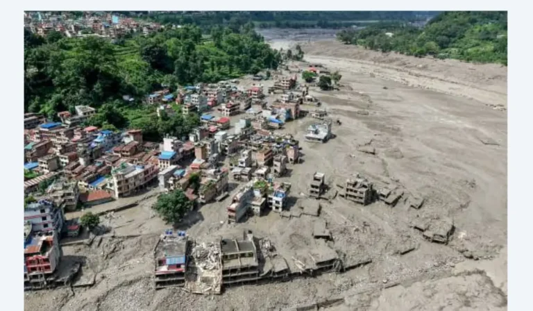
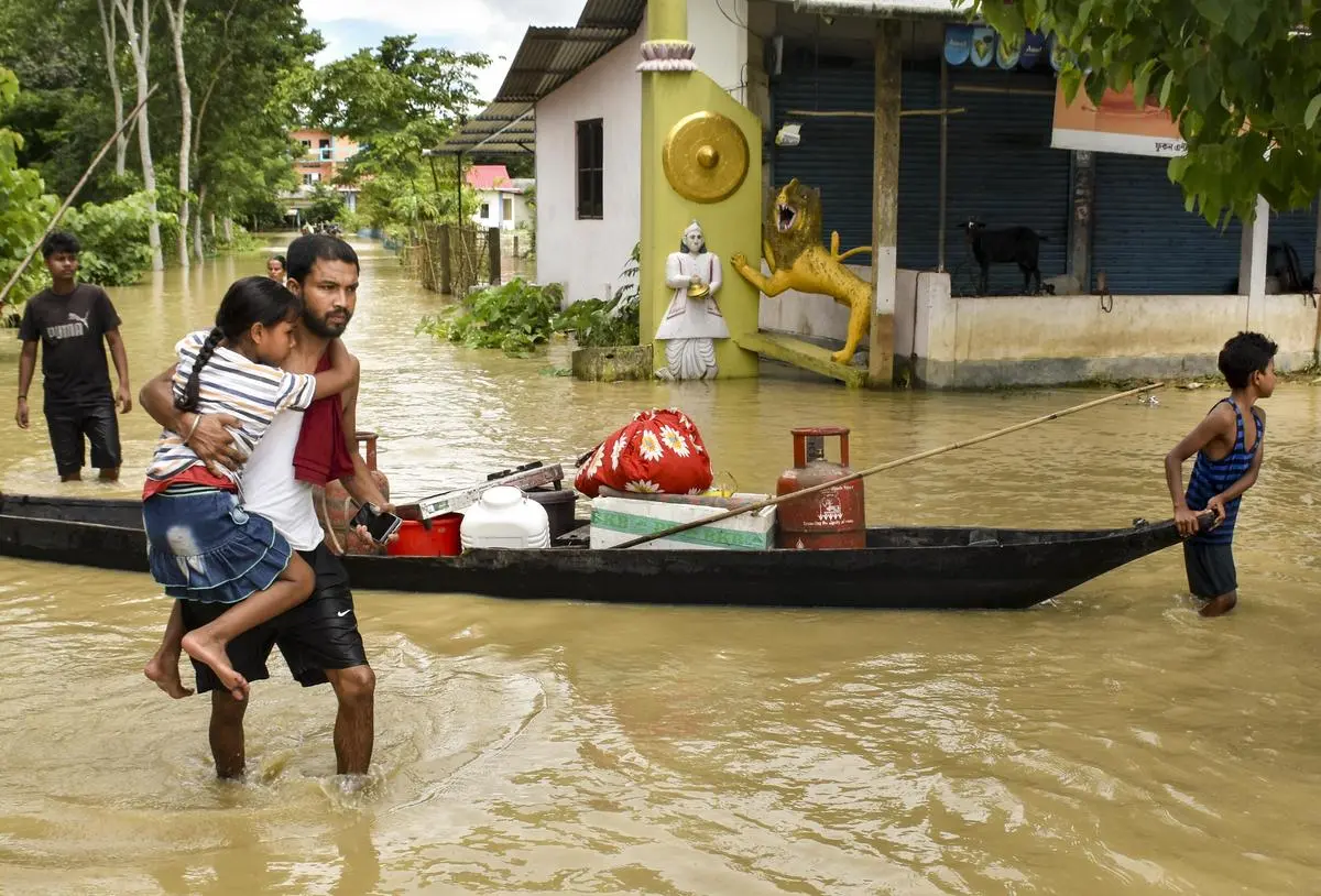
Assam Floods 2026: 78 Dead, 3 Lakh Affected — The Real Numbers Behind the Crisis (Live Updates)
Every monsoon, Assam braces for flooding. Most years, that bracing is enough. This year, it wasn’t.
As of the latest Assam State Disaster Management Authority (ASDMA) bulletin, the 2026 floods have killed 78 people, affected more than 3 lakh residents, submerged 551 villages, and destroyed over 21,500 hectares of cropland. And the India Meteorological Department (IMD) says more heavy rain is on the way — meaning this number isn’t final.
This article pulls together only verified, government-sourced figures — from ASDMA, IMD, and official statements from the Assam Chief Minister’s Office and Union Ministers — so you’re working with facts, not guesses. It’s structured to be updated as the situation changes, so bookmark it if you’re tracking this closely.
Quick Answer
- Death toll: 78 (as of July 30, 2026), per ASDMA
- People affected: 3,00,031 across 7 districts, per ASDMA’s latest bulletin
- Peak impact (July 24, 2026): Over 7.2 lakh people affected across 11 districts before the situation partially improved
- Worst-hit districts: Sivasagar, Charaideo, Golaghat, Jorhat, Nagaon, Biswanath, and Kamrup Metro
- Cause: Assam Chief Minister Himanta Biswa Sarma attributed the Upper Assam floods to 500% excess rainfall, not a cloudburst
- Outlook: IMD has warned of heavy to very heavy rainfall over the next three days, raising the risk of renewed flooding in areas that were just starting to recover.
Table of Contents
- How the 2026 Flood Crisis Escalated: A Verified Timeline
- Current Situation: The Numbers Right Now
- Which Districts Are Affected — And How Badly
- What’s Actually Causing the Floods
- Government Response: Centre and State Action
- Relief Camps and Rescue Operations
- Damage to Crops, Livestock, and Infrastructure
- Is This “Unprecedented,” or Is This the New Normal?
- How You Can Verify These Numbers Yourself
- Key Takeaways
- FAQs
How the 2026 Flood Crisis Escalated: A Verified Timeline
Numbers in flood coverage move fast, and outdated figures spread just as fast. Here’s the actual progression, sourced entirely from ASDMA daily bulletins and PTI/ANI wire reporting that cites those bulletins directly.
| Date | Deaths | People Affected | Districts Affected | Source |
|---|---|---|---|---|
| June 3, 2025 (last year, for comparison) | — | 5,00,000+ | 21 | ASDMA / All India Radio |
| Early stage, 2026 | 12 | 6,30,000+ | 21 | ASDMA |
| July 24, 2026 (peak) | 47 | 7,21,000+ | 11 | ASDMA flood bulletin |
| July 26, 2026 | 66 | 6,54,800+ | 6 | ASDMA midnight bulletin |
| July 29–30, 2026 (latest) | 78 | 3,00,031 | 7 | ASDMA / ANI |
What this table tells you: the crisis peaked around July 24 with the widest geographic spread (11 districts, 7.2 lakh affected), then began improving as waters receded in several districts — but the death toll kept climbing even as the affected population fell, because flood-related deaths (drowning, infrastructure collapse, disease) often lag behind the peak of the water itself.
Current Situation: The Numbers Right Now
Per ASDMA’s most recent flood report and corroborating wire coverage (as of July 30, 2026):
- Death toll: 78 — three additional deaths were confirmed on July 29 alone (two in Sivasagar, one in Golaghat)
- People affected: 3,00,031
- Districts currently affected: 7 — Sivasagar, Charaideo, Golaghat, Jorhat, Nagaon, Biswanath, and Kamrup Metro
- Revenue Circles affected: 21
- Villages affected: 551
- Crop area damaged: 21,523.08 hectares
- Relief camps: 71 active camps, sheltering more than 16,500 displaced people, with an additional 72,000+ people being supported through 30 relief distribution centres
- Livestock impact: Over 11,000 animals washed away, and roughly 17,000 more affected
One important nuance the raw numbers don’t show on their own: Kamrup Metro (which includes Guwahati) is dealing with urban flooding rather than riverine flooding — localities like Zoo Road, Rukminigaon, Hatigaon, and Lachit Nagar have been affected, which is a different kind of disaster response challenge than a rural district where the Brahmaputra has breached its banks.
Which Districts Are Affected — And How Badly
Flood impact in Assam is never evenly distributed. Based on ASDMA district-wise data through the crisis:
Worst-hit at peak (per ASDMA, July 24–26 bulletins):
- Sivasagar — the single worst-affected district throughout the crisis, with close to 3.8 lakh people affected at its peak
- Charaideo — around 1.9 lakh people affected at peak
- Jorhat — over 1.2 lakh people affected at peak
Other districts that saw significant impact during the wider phase of the crisis (July 24 bulletin, 11-district count): Dibrugarh, Hojai, Kamrup, Kamrup Metropolitan, Karbi Anglong, Nagaon, and Tinsukia.
Currently active flood zones (as of July 30): Sivasagar, Charaideo, Golaghat, Jorhat, Nagaon, Biswanath, and Kamrup Metro.
Two rivers are named specifically in ASDMA’s bulletins as flowing above the danger level during this crisis: the Dikhow River at Sivasagar and the Dhansiri River at Numaligarh. The Brahmaputra itself and several of its tributaries have also crossed danger-mark levels at multiple gauge stations through the season.
What’s Actually Causing the Floods
This year’s flooding isn’t being driven by a single freak event — Assam Chief Minister Himanta Biswa Sarma was specific about this, stating publicly that Upper Assam’s flooding was the result of 500% excess rainfall, explicitly ruling out a cloudburst as the cause.
Three factors are compounding the impact, based on official statements and geographic patterns confirmed across multiple flood bulletins:
- Sustained, above-normal monsoon rainfall across Assam itself
- Heavy rainfall in neighbouring Arunachal Pradesh, which feeds directly into Assam’s river systems — this is a recurring pattern (the same dynamic was cited by the Assam CM in the 2024 flood cycle as well)
- Riverbank erosion and pre-existing embankment weaknesses, which mean rivers breach their banks at lower thresholds than they would with fully intact flood infrastructure
This is worth understanding because it shapes what “solving” this problem would actually require — it’s not just about responding faster to floods, it’s about upstream rainfall management, embankment reinforcement, and regional coordination with Arunachal Pradesh’s river systems.
Government Response: Centre and State Action
Both the Assam state government and the Union (Central) government have been publicly engaged with the crisis at a high level. Here’s what’s actually been confirmed, not just promised:
State government (ASDMA-coordinated):
- Daily flood bulletins issued to track deaths, displacement, and damage
- 71 relief camps and 30 relief distribution centres currently operational
- Assam Ministers, MLAs, and party officials personally distributing relief materials — 30 trucks of food, clothing, and essential supplies were flagged off for the worst-hit districts on July 29
- Power supply reported restored in the majority of flood-affected areas as of July 28, per the Chief Minister’s office
Central government:
- Prime Minister Narendra Modi held direct phone reviews with Assam CM Himanta Biswa Sarma on July 25 and with Union Minister Sarbananda Sonowal on July 26
- On July 28, PM Modi met Assam MPs, including Union Ministers Sarbananda Sonowal and Pabitra Margherita, for an in-person review of the situation
- A six-member Inter-Ministerial Central Team (IMCT), led by a Ministry of Home Affairs Joint Secretary and including officials from the Central Water Commission, Ministry of Finance, Ministry of Rural Development, Ministry of Road Transport and Highways, and the National Remote Sensing Centre, toured flood-ravaged Charaideo district to assess damage
- Union Minister Sonowal announced that a Central assessment team’s findings would determine the scale of special financial assistance to be released to Assam
As of this writing, the exact rupee figure for Central financial assistance for the 2026 floods specifically had not yet been officially announced — the IMCT’s assessment report is expected to determine that. (For context: in a comparable past flood year, the Centre released an initial Rs 346 crore under the Flood Management Programme — but that figure is historical, not a confirmed number for 2026, and shouldn’t be quoted as this year’s allocation.)
Relief Camps and Rescue Operations
- 71 relief camps are currently active, housing more than 16,500 displaced people
- An additional 72,000+ people are being supported through 30 relief distribution centres (people who need food/supply support but aren’t necessarily housed in camps)
- At an earlier, wider phase of the crisis, ASDMA reported 358 relief camps and distribution centres operating across nine districts, caring for over 24,000 displaced people at that point — the drop in active camps reflects the partial recession of floodwaters in some districts, not a reduction in overall need
- Rescue operations have involved the Army, NDRF (National Disaster Response Force), SDRF (State Disaster Response Force), Fire & Emergency Services, police, and civil agencies, with roughly 5,000 people rescued from Golaghat, Jorhat, and Sivasagar during the height of the crisis
Damage to Crops, Livestock, and Infrastructure
Flood coverage often focuses on human toll and understates the economic damage, so here are the specific, ASDMA-sourced figures:
| Category | Impact |
|---|---|
| Crop area damaged | 21,523.08 hectares (current); had reached 34,970.8 hectares at an earlier, wider peak |
| Villages affected | 551 (current); had reached 883 at peak |
| Animals washed away | 11,000+ |
| Livestock otherwise affected | ~17,000 head |
| Infrastructure | Embankments, roads, bridges, and schools damaged across multiple districts |
For a largely agrarian state, crop damage of this scale has knock-on effects well beyond the immediate flood period — it affects household income, food security, and local market prices for months after the water recedes.
Is This “Unprecedented,” or Is This the New Normal?
It’s worth being honest about something most flood coverage glosses over: Assam’s floods get called “unprecedented” almost every single year. That’s not because the word is being used carelessly — each year does bring some genuinely new peak (a higher death toll, more villages submerged, a longer duration) — but it also means the state is dealing with what’s functionally become a recurring annual disaster, not a one-off emergency.
For comparison: the 2025 Assam floods affected over 6.3 lakh people and claimed at least 26 lives, according to conservative contemporaneous estimates. The 2026 floods have already more than tripled that death toll, even with the affected-population count currently lower than 2025’s peak. That’s a meaningful shift — it suggests this year’s floods, while affecting somewhat fewer people at the current snapshot, have been considerably more lethal per capita affected.
This pattern is part of why disaster researchers and Assam-based journalists increasingly frame flooding here not as a single emergency to “recover from,” but as a structural, recurring risk that needs long-term infrastructure and river-management solutions — embankment reinforcement, upstream coordination with Arunachal Pradesh, and climate-adjusted flood forecasting — rather than only emergency response after the fact.
How You Can Verify These Numbers Yourself
Flood statistics change daily, and misinformation spreads fast during disasters. If you want to check the latest figures directly rather than relying on secondary reporting, these are the official channels this article draws from:
- ASDMA Assam Flood Report portal: asdma.assam.gov.in/information-services/assam-flood-report — the primary source for daily death toll, affected population, and district-wise breakdowns
- ASDMA Flood Alerts: asdma.assam.gov.in/resource/flood-alerts
- India Meteorological Department (IMD): for rainfall warnings and forecasts
- Assam Chief Minister’s Office official statements and social channels, for state-level response updates
- ReliefWeb (UN OCHA-affiliated humanitarian reporting): reliefweb.int — publishes “Saarathi Alert” situation reports for Assam that compile official data for humanitarian response coordination
If a number you see elsewhere doesn’t match what ASDMA’s own portal currently shows, trust ASDMA’s live bulletin over any single news article — including this one, since these figures are a snapshot as of July 30, 2026, and will have moved by the time you’re reading this.
What Happens Next
- Watch IMD’s rainfall warnings over the next few days — a fresh spell of heavy rain could reverse the partial recovery already made in districts like Charaideo, Sivasagar, and Jorhat.
- Watch for the IMCT’s damage assessment report, which will determine the scale of Central financial assistance released to Assam.
- If you’re tracking India’s broader 2026 protest and unrest landscape alongside disaster coverage, it’s worth understanding how differently a crisis like this compares to organised political protest — for instance, the E20 Janta Party’s demonstrations at Delhi’s Jantar Mantar show how a completely different kind of public pressure — digital-first, demand-driven — has been building in India this year, independent of natural disasters like this one.
Key Takeaways
- As of July 30, 2026, Assam’s floods have killed 78 people and affected 3,00,031 across 7 districts, per ASDMA.
- The crisis peaked around July 24, 2026, with 7.2 lakh people affected across 11 districts — the death toll has kept rising even as the affected-population count has fallen.
- Assam’s CM attributes the flooding to 500% excess rainfall, not a cloudburst — heavy rain in neighbouring Arunachal Pradesh is a compounding factor.
- 71 relief camps and 30 relief distribution centres are currently active, supporting close to 90,000 people combined.
- Over 21,500 hectares of cropland and 28,000+ animals have been affected.
- IMD has warned of more heavy rain, meaning the situation is not resolved — treat any single day’s figures as a snapshot, not a final total.
Frequently Asked Questions
What is the current, most accurate death toll in the Assam floods 2026?
As of the latest ASDMA bulletin (July 30, 2026), the confirmed death toll is 78. This number is updated daily by ASDMA — always check their official flood report portal for the most current figure.
How many people are currently affected by the Assam floods?
3,00,031 people across 7 districts, per ASDMA’s latest data. This is down from a peak of over 7.2 lakh people across 11 districts on July 24, 2026, as floodwaters have receded in several areas.
Which Assam districts are worst affected right now?
Currently active flood-affected districts are Sivasagar, Charaideo, Golaghat, Jorhat, Nagaon, Biswanath, and Kamrup Metro — with Sivasagar consistently the worst-hit throughout this year’s crisis.
What caused the 2026 Assam floods?
Assam’s Chief Minister attributed the Upper Assam flooding specifically to 500% excess rainfall — not a cloudburst. Heavy rainfall in neighbouring Arunachal Pradesh, which feeds Assam’s rivers, and riverbank erosion have compounded the impact.
Is the flood situation improving or getting worse?
It’s mixed. Water levels have receded in several districts (Charaideo, Sivasagar, Jorhat saw improvement around July 26–27), but IMD has warned of heavy to very heavy rainfall over the following three days, which risks re-flooding areas that were just starting to recover.
How is the government responding to the Assam floods?
Both the Assam state government (through ASDMA, relief camps, and ministerial relief distribution) and the Central government (through Prime Minister-level reviews, a six-member Inter-Ministerial Central Team assessment, and promised financial assistance) are actively engaged. The exact Central financial assistance figure for 2026 has not yet been officially finalised as of this writing.
How does the 2026 flood compare to previous years?
The 2025 Assam floods affected over 6.3 lakh people and killed at least 26. The 2026 floods have already caused significantly more deaths (78) despite a currently lower affected-population count, suggesting this year’s flooding has been more lethal relative to its reach.
Where can I donate or find verified relief efforts?
This article doesn’t endorse specific third-party relief organisations, since verifying an organisation’s legitimacy is outside its scope. For official, government-coordinated relief, ASDMA’s portal (asdma.assam.gov.in) is the correct starting point, and it lists officially operating relief camps and distribution centres.
This is a developing situation. If you’re reading this some time after July 30, 2026, treat every figure above as historical context and check ASDMA’s official flood report portal for current numbers.